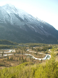
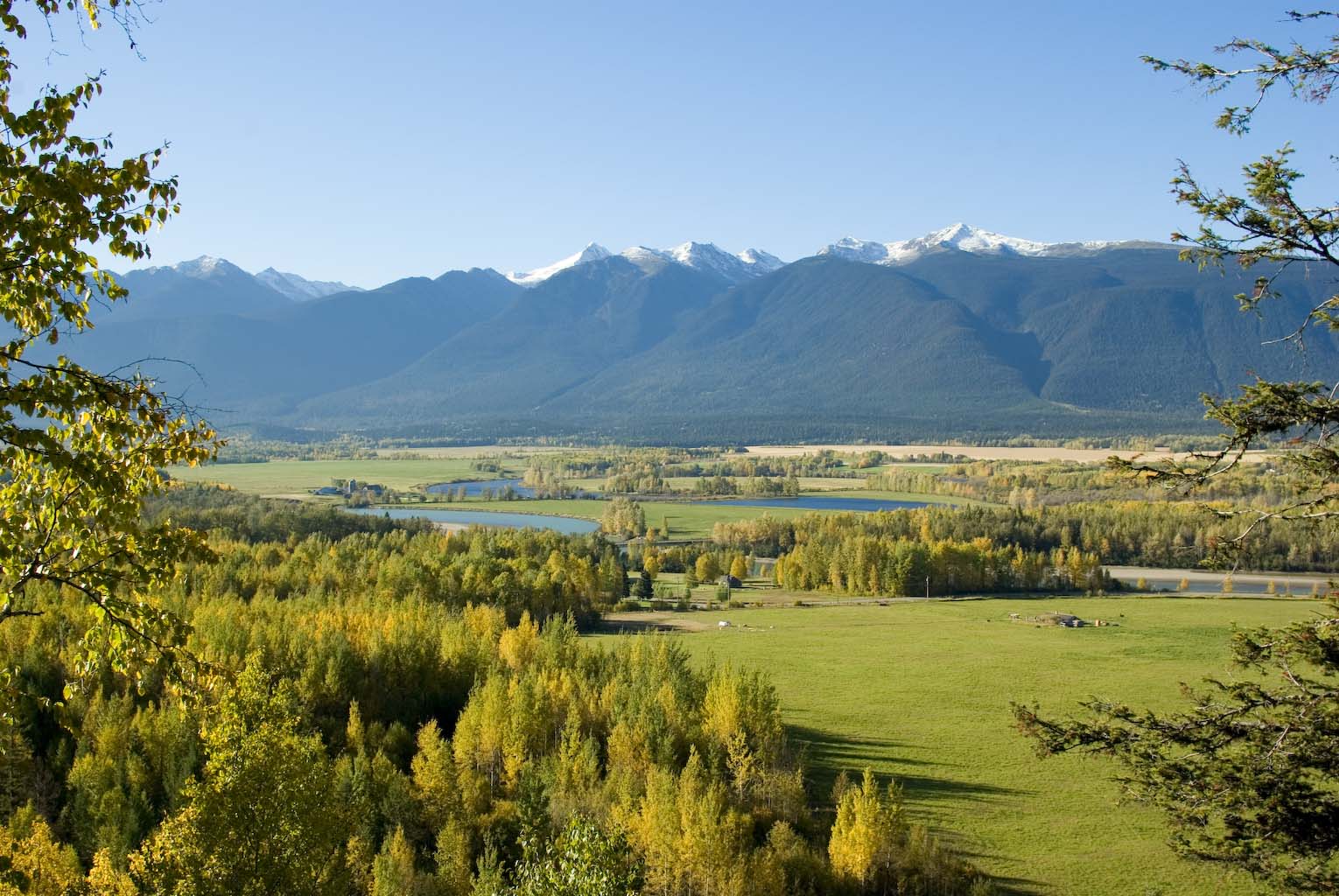
Welcome to the Robson Valley – there is so much to see and do!
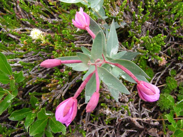
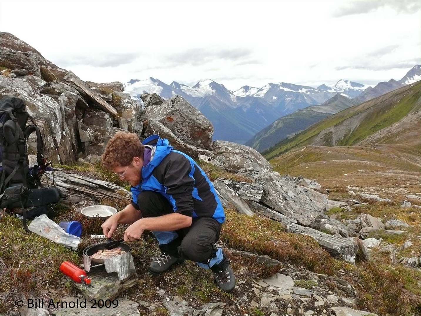
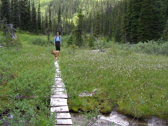
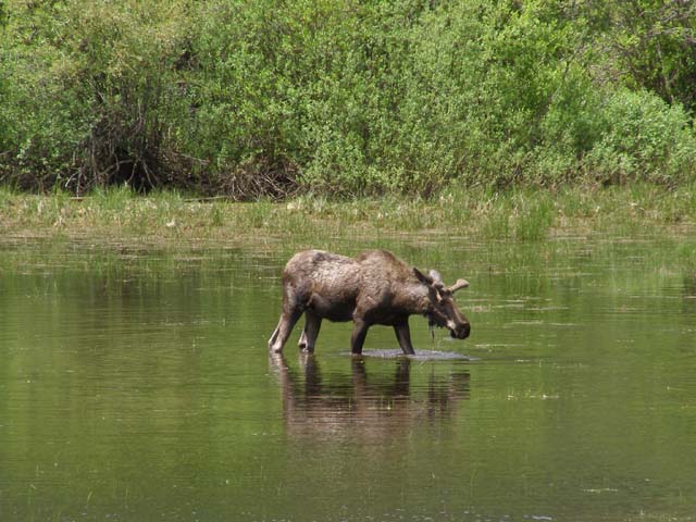
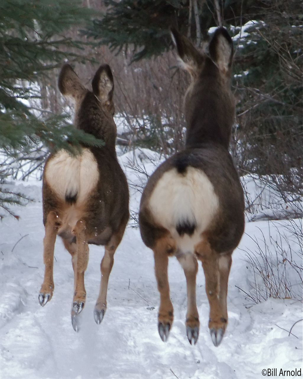
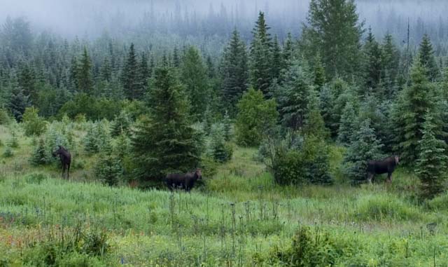
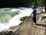
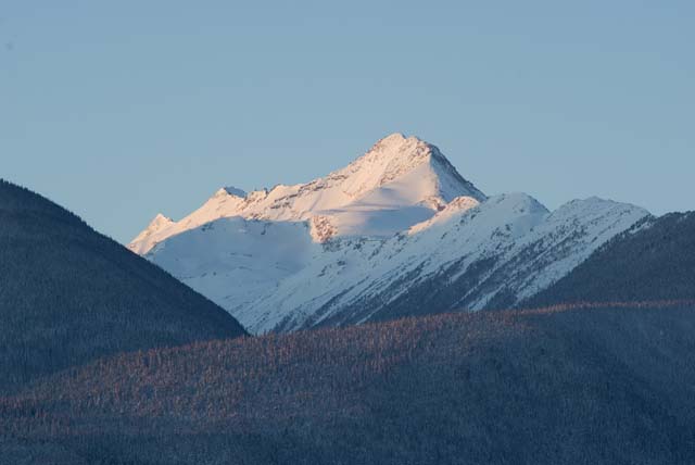
The area’s varied terrain ensures incredible hiking, mountain biking, boating and camping experiences during the summer months and cross country skiing, snowshoeing and snowmobiling during the winter season. Wildlife and bird watching opportunities are plentiful year round and the night skies are clear and dark for stargazers to enjoy.
Remember, hiking and exploring the back country can be dangerous for the unprepared. Hazards include sudden weather changes, wild animals, steep terrain, avalanche hazards, crevasses etc.
Be Prepared!
- Carry with you:
- Topographic map and magnetic compass – and learn how to use them.
- Flashlight (with extra batteries and bulb)
- Extra clothing (including mittens, hat, jacket and rain gear)
- Sunglasses
- Extra food and water
- Waterproof matches in waterproof container
- Candle/Fire starter
- Pocket knife
- First aid kit
- Space blanket or two large heavy-duty trash bags – These items can help provide shelter in an emergency situation and can be used as a raincoat or a windbreak.
Educate yourself about the particular hazards of the area, i.e. wildlife, steep terrain, sudden weather changes etc – and be prepared.
Plan your trip and let other know where you are going and when you are likely to be back.
Know your limitations and stay safe!
A good website to visit is: www.bcadventure.com/adventure/hiking/safety.htm
There is an excellent selection of nature, safety and map books as well stories and histories for reading in the tent available for sale at the McBride Visitor Centre. Also available is Rob Bryce’s comprehensive guide – Hiking North Central BC (with interactive CD) as well as a good selection of other hiking guides.
In McBride itself we have a number of things to see and do.
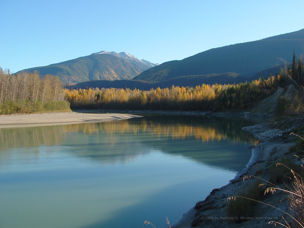
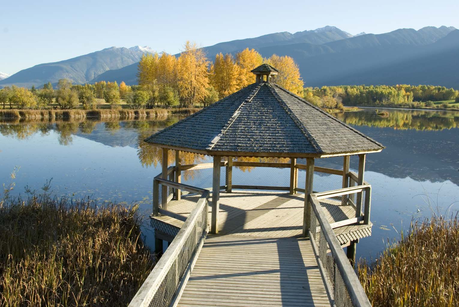
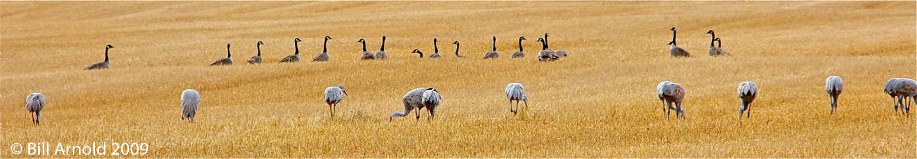
Horseshoe Lake is a naturally formed ox-bow lake with an observation platform for viewing waterfowl and other bird species. A complete bird list is available at the Visitor Centre and we have an active bird watching community.
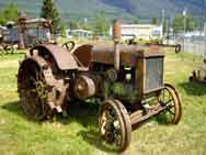
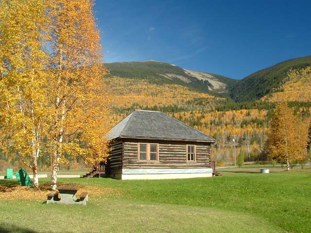
Our local Museum and Archives has an outdoor exhibit of antique farming equipment on display across from Bill Clark Ball Park, on Second Avenue west, and many exhibits and activities at 521 Main Street.
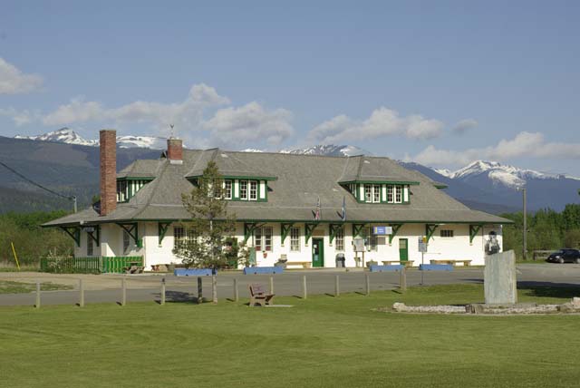
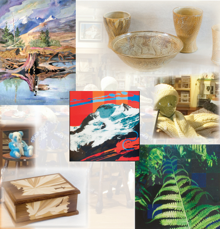
The heritage train station on 1st Avenue is decorated throughout with historical photos and houses a gallery of quality work by local artists and crafters, as well as the Visitor Info Centre and a coffee shop.
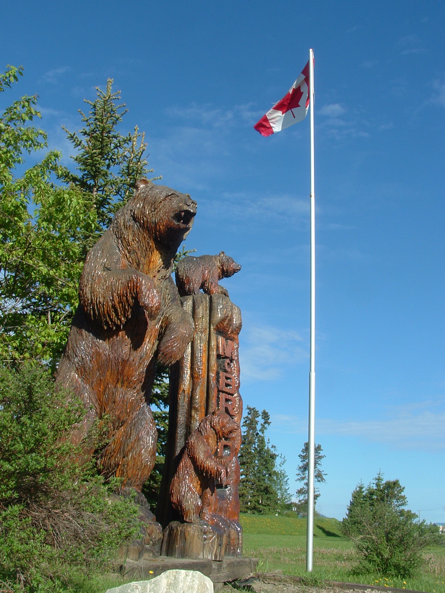
Our McBride Bears, an unforgettable family of oversized chainsaw carved bears, who welcome visitors alongside the Village Office complex.
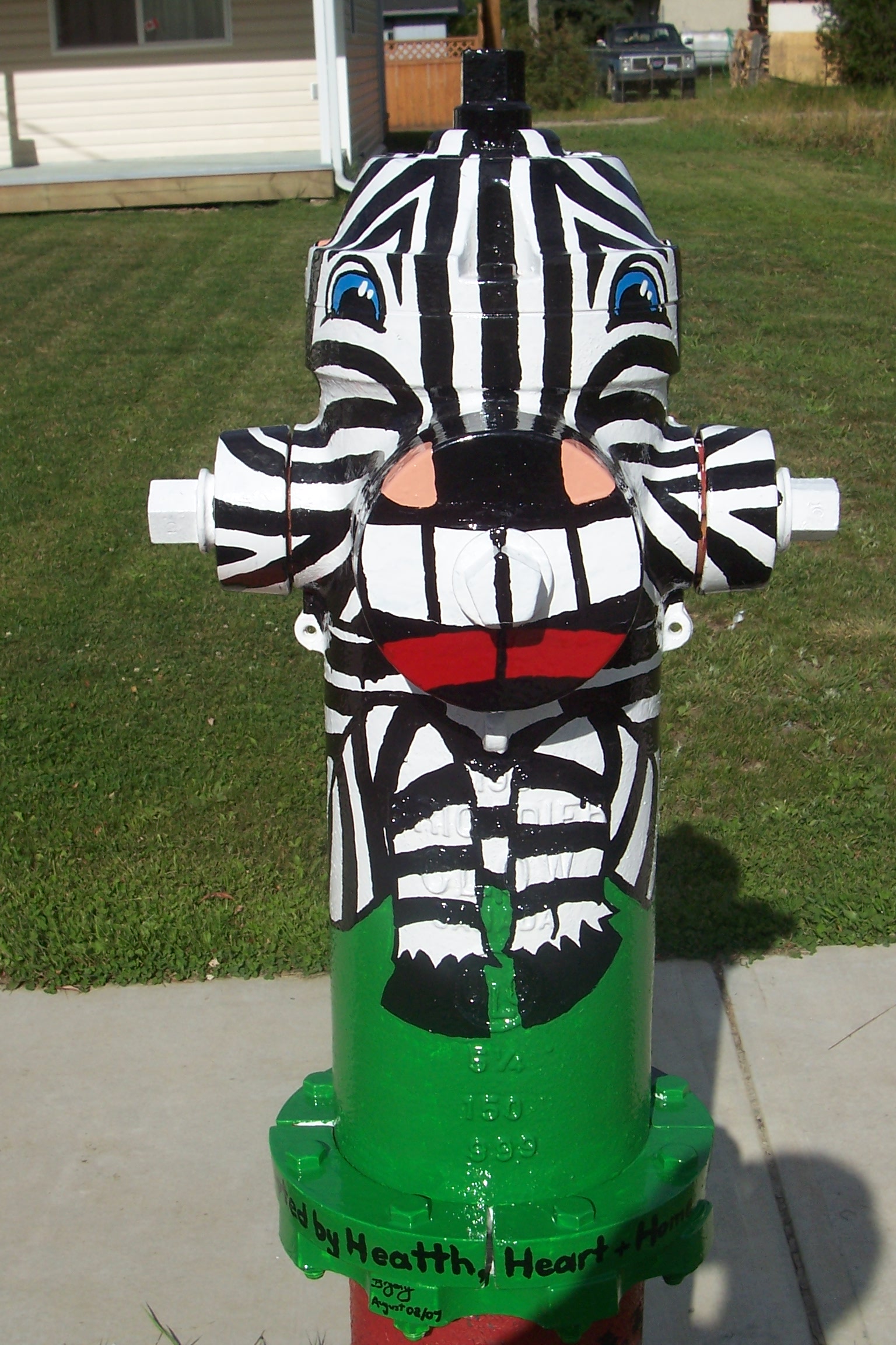
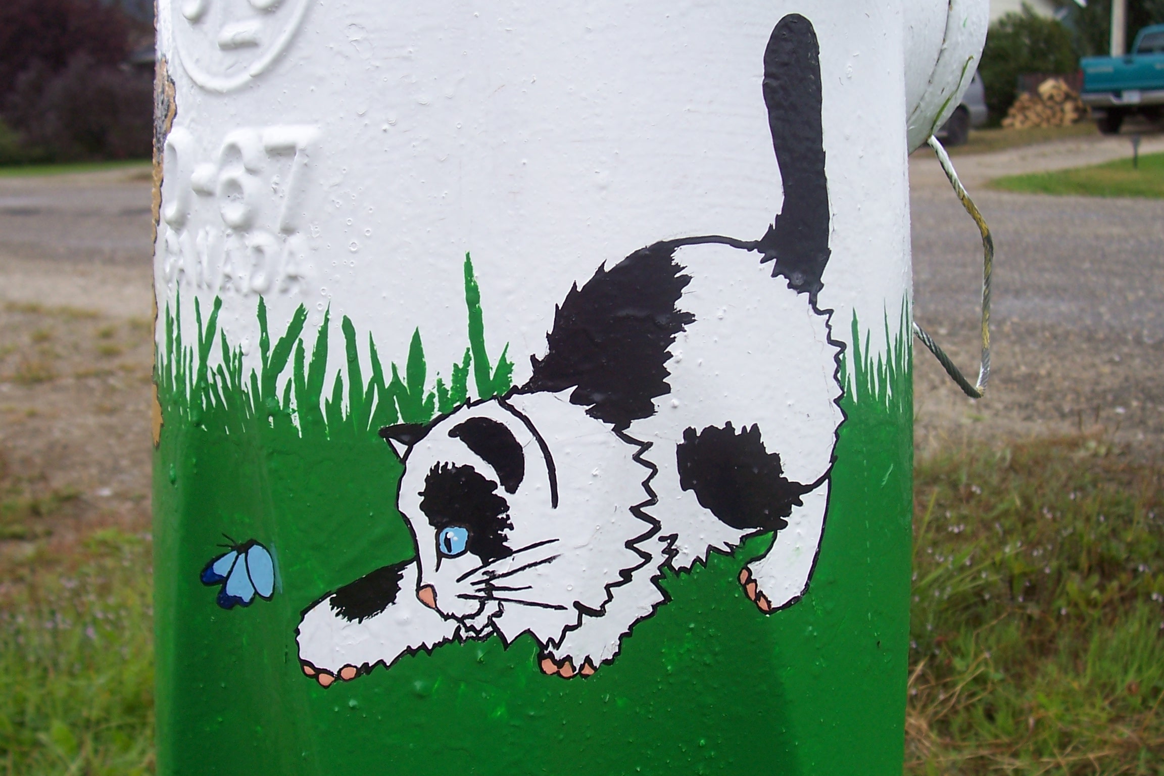
The Whistle Stop Gallery is a local artist’s cooperative that not only offers quality arts and crafts for sale, but is also active in the community. They have created an art walk, with pieces from local artisans on display throughout the Village, painted murals on various building and undertook to turn the fire hydrants in town into miniature works of art. One of the local artists has created a model of the solar system throughout the town so visitors and residents can stroll through our solar system as they meander through the Village.
There is a fabulous playground in the Village Park, across from the train station, plus a playground at the Elementary School.
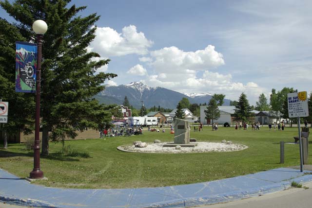
There’s also a ball field, the Recreation Centre (ice rink, curling, and convertible courts), Koeneman Regional Park on the edge of town and local walking trails.
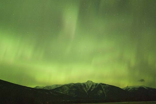
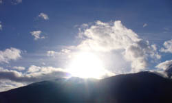
The night sky is dark in most of the Robson Valley and it is an ideal spot for astronomers and stargazers. When solar activity is high the northern lights put on an awesome display.
History
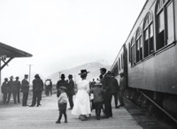
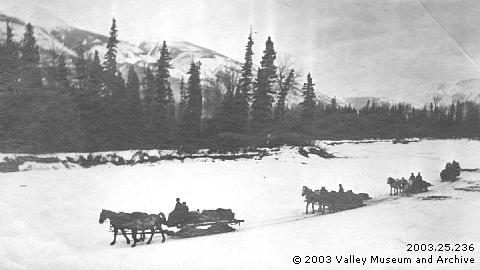
McBride has a rich history, for centuries the Yellowhead Pass was an aboriginal trading route. The nineteenth century brought explorers, gold seekers and surveyors, and in 1872 Sir Sanford Fleming and his engineers began surveying to find railway routes through the pass. The Grand Trunk Pacific Railway Company surveyed a railway route from the prairies west to the coast, and railway construction took place from 1911 to 1914 when the first passenger train went through to the new port of Prince Rupert.
The site of McBride was surveyed and established as a divisional point on the railway in 1912, and its first station was claimed, for a while, to be the largest between Winnipeg and Prince Rupert. The yards had eight miles of track in addition to a roundhouse, turntable, bunkhouse, two water towers, a dam and an ice house. The present station, opened in 1919, was built on the foundation of the original, destroyed by fire in 1918.
The Village of McBride was laid out in a standard Grand Trunk Pacific Railway design with a park behind the station to be planted with flowers for the enjoyment of the railway passengers. During and after construction this park between the station and the business section was a sea of mud. The easiest solution was to take the roundhouse cinders in a wheelbarrow and gradually build a path. The mud is gone, but the path remains beside the spruce trees and the sidewalk.
As a newly constructed railway town, the community was known as Mile 90, it being 90 miles from Summit at the boundary with Alberta. In 1913 it was named McBride after Richard McBride, the Premier of British Columbia.
During the summers of 1911 to 1913, sternwheelers brought people and materials up to Tete Jaune and down to Fort George. As part of railway construction, sawmills were set up, and at Tete Jaune balks of timber were cut to make scows. The scows had a one way trip down the Fraser River to Fort George with construction materials and other supplies. Main Street and Bridge Road in McBride lead to the site of the Fraser landing where sternwheelers, motor boats and scows tied up.
For the visitor, there are a number of historic buildings that are easily accessible.
Anglican-United Church Hall, Dominion Street
This hall was built as a Methodist Church, the first church in McBride, by the Reverend Frank Bushfield, the first minister in McBride. It was originally built on the north-east corner of Queen Street and Fourth Avenue. The church was opened on May 24th, 1914 with celebration by the whole community. The church was built away from the centre of town, anticipating quick growth, but World War I changed the expectations and the town diminished. The church was moved in 1922 to the elementary school lot on Third Avenue.
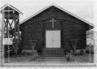
In 1967 a new United Church was built on Dominion Street and the original church was moved beside it for the church hall.
Elks’ Hall, Holdway Street
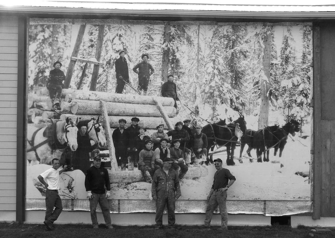
The Empress Theatre was opened in August, 1914, a few days after the start of World War I. It was originally a ‘moving picture house’ which was also used for many community functions – large meetings, dances, special celebrations. It was sold several times but always well used by the community. It was bought by the Elks’ Lodge in spring 1939 and became known as the Elks’ Hall. In 2008 a large photo mural, depicting one of the pioneering forestry men in the area, Sig Harstad.
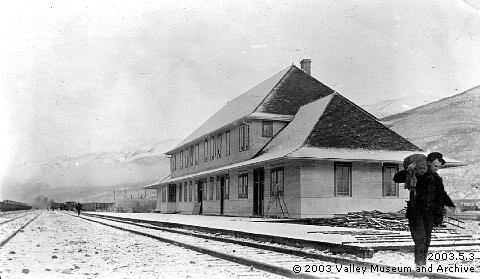
Railway Station, First Avenue
The original station on this site was built by the Grand Trunk Pacific Railway in 1913, and for a time was reputed to be the largest between Winnipeg and Prince Rupert. It burnt down in 1918 and was replaced by the present station, built on the original foundations and opened in 1919. The last train was dispatched from the station in 1989 after which the station was closed for a decade until it was brought back to life in its present form.
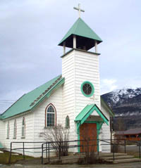
St. Patrick’s Roman Catholic Church
The church was given to the congregation by Bishop Bunoz and dedicated on March 17th, 1937. The previous church a short distance away is now a private home.
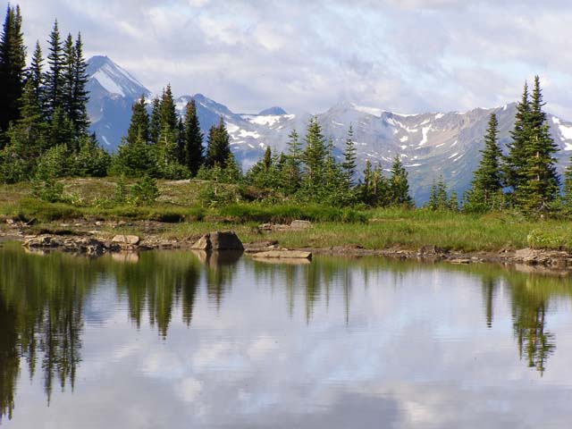
Outdoor Recreation in the Robson Valley
With a bit of a drive you can access a wealth of outdoor recreational trails and sites:
Hiking Trails West of McBride:
–
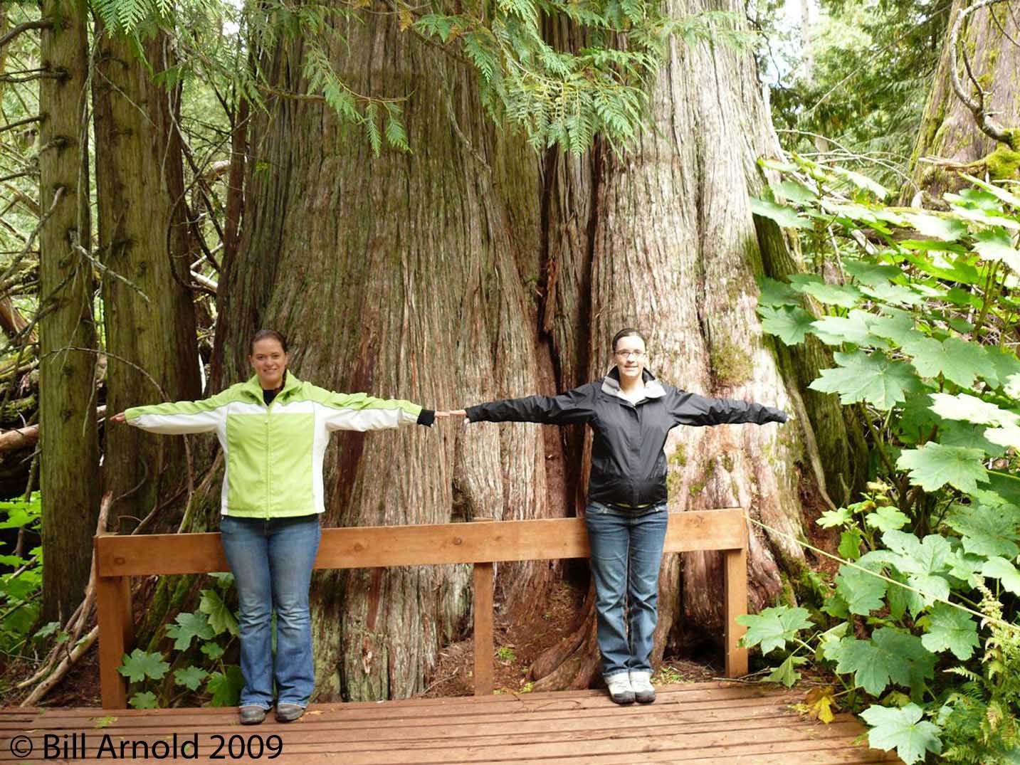
Ancient Forest:
2.3km GPS location parking lot: 53 45.7702N 121 13.0235W 617532.7E 5958393.7N 10 Elevation: 2594 ft/791m Located 94 km west of McBride on Hwy 16. At the trail sign on highway turn left and drive 50m through gravel pit to parking lot. There are 2.3 km of trails. The trail follows a road for 250m to edge of cedar forest and 100 m to the trail junction. The left fork is a more direct route to waterfall, the right fork winds through large cedar trees. The right fork continues for 300m to another junction. At this junction the right fork leads 150m to Treebeard Falls, and the left fork to the Treebeard.
Avalanche Valley:
Drive 5 km west of McBride on Highway 16 and turn left onto Dore River Road. After 1.9 km the road turns to gravel. At 8.1km turn left onto the Dore South Forest Service Road. After 21km, you come to a sign “Eagle Valley Trail Left”. Drive past the Eagle Valley turnoff and reach the parking lot at the end of the road… Spectacular view of the magnificent Roberts Glacier, the mountain ranges to the south and west, and the entire upper Cottonwood River Valley.
Bell Mountain:
2.9km from end of road. GPS location Bell Mtn. Recreation Site/Parking: 53 18.2622N 120 19.3352W 678425.9E 5909257 .2N 10 Elevation: 5140ft. /1567m. Located 9.3km west of McBride on Hwy 16. Turn left on Bell Mnt Road. Stay right after 830m. Stay left at 3.6km. Continue past the ski area and ski cabin to the left. Continue another 14.5km to the recreation site. 4wd recommended beyond this point. The hiking trail accesses the new cabin. Continue up past the cabin and follow the poles from an old ski lift. 500m to the top of Little Bell.
Boulder Mountain Trail:
5.1km to cabin and 6.8 to peak. GPS trailhead: 53 28.7334N 120 35.1786W 660171.8E 5928257.2N 10 Elevation: 2874ft/875m. Located 34km west of McBride on Hwy 16. Turn right on the Goat River Forest Road. {3.5km before Goat River}. Trailhead parking is 1.2km down the road to the right. Follow the trail for 1.1km then turn left into cedar hemlock forest. Watch for forest service trail sign and lots of ribbon or you’ll pass the trail. At 5km mark the trail enters alpine meadows then turns right and passes a burnt cabin. Summit is another 2km. Spectacular view from the summit. BC Parks.
Driscoll Ridge:
5.4km to peak. GPS main trailhead: 53 47.6902N 121 16.4829W 613645.8E 5940782.4N 10 Elevation: 2445ft/745m. Located 99km west of McBride on Hwy 16. Turn left onto a side road. There is a “Driscoll Trail” sign at the entrance. There are a few parking spots on the side of the road just off the hwy. Approx. 250m up a washed out logging road turn right at a junction, and hike 50m until you reach a trail to the left. The trail is a 15.5km loop from the main trailhead to the Ancient Forest trailhead.
Eagle Valley Creek:
Moderate 9km from trailhead to cabin, 1.8km from cabin to glacier. GPS trailhead: 53 10.3938N 120 21.1944W 676895.6E 5894812.7N 10 Elevation: 4164ft / 1269m. Drive 5km west of McBride on Hwy 16. Turn left on the Dore River Road. After 1.9km road turns to gravel. At 8.1km turn left onto the Dore South Forest Service Rd. After 21km, you come to a sign “Eagle Valley Trail Left”. Take the left fork and drive 200m over Dore River to parking lot. Start of the trail is on the deactivated road east. There are many magnificent views of mountains on either side of the large glacier. The cabin is 9km from the trailhead. It has a woodshed and outhouse. Reservations for the cabin can be made through the Ozalenka Alpine Club @250-569-2596.
Erg Mountain:
8.8km from Ptarmigan Creek crossing. GPS trailhead: 53.34.4486N 120 51.5884W 641711.8E 5938055.6N 10. Elevation: 2890ft / 881m. Located 53km west of McBride on Hwy 16. Turn left onto the Catfish Forest Rd. and drive 5km to Ptarmigan Creek (stay right at fork just before Ptarmigan creek).There is no bridge over Ptarmigan creek so you can go15m across a cable that is attached to old bridge abutments on each side. Follow the old gravel pit road about 2km until you reach the Erg Mountain Trail sign in a grove of western hemlock. The trail becomes very steep through a hemlock and cedar forest. Watch for signs of grizzly bear. Great views of the mountains.
Morkill Old-Growth Cedar Trail:
Moderate/8km. Located approximately 50 km west if McBride near Crescent Spur. From Highway 16 go 7km on Loos Road (north) to the Morkill Forest Service Road (FSR) on the right (north). Travel the Morkill FSR for 10km. After driving 2/3 through a large clear-cut that started at 10km, there will be a small clear-cut hill at 11km on your right (east). The trailhead is on the east end of the clear-cut, on the north side of the base of the small clear-cut hill. Park on the right (east) side of the road and walk through the clear-cut towards the small clear-cut hill, with a spruce-fir-cedar forest edge on your left (northeast) until you come to a magnificent cedar grove at the trailhead. This trail is in a v-shaped valley with large cedar on all sides, and huge devils clubs along a small stream.
Mountain Lion Cedar Trail:
Moderate/10km. Located approximately 50 km west of McBride near Crescent Spur at 1km on the Morkill FSR (see D. MORKILL OLD-GROWTH CEDAR TRAIL above for directions to Morkill FSR). As soon as you cross the Fraser River bridge at 1km you will see a gravel road on your right (east). The trail begins on the hill just to the left (north) of this gravel road in the forest traveling parallel with the Fraser River. This is an impressive trail with large trees of several species, rock outcrops, views of the Fraser River, and groves of very large, old cedar (over 12 feet in diameter, after 2km). Look for deer, moose, wolf, cougar, and fisher sign, and a large variety of birds.
Goat River Canyon Trail:
Moderate/8km from highway. Located 35km west of McBride on Highway 16. The trail is accessed by an old road on the right (south) side of Highway 16, 1/2km before the Goat River bridge and rest area. The old road is easily missed by those driving on Highway 16, because of the steep drop it takes off the highway. It is best to park at the Goat River Rest Area and walk west on the left (south) side of Highway 16 to spot the access road. This is a 4-wheel drive road at the best of times which turns into a hiking trail at about 2km. Thousand year-old large cedar with silver tree bark, moss covered forest floor, salmon spawning grounds, and the Goat River
rock canyon end-point make this a very special trail. Watch for grizzly and wolf sign plus a large variety of birds.
Kristi Glacier:
Moderate 10.9km from bridge out to glacier. GPS trailhead/Parking (bridge out): 53 12.1034N 120 26.7638W 670585.8E 5897539.0N 10. Elevation: 4346ft / 1325m. Drive 5km west of McBride on Hwy 16 and turn left on Dore River Rd. just after the Dore River bridge. After 1.9km the road turns to gravel . You will reach a junction with an Ozalenka Trailhead sign. Take the right fork and drive another 7.4km to another junction with an Ozalenka Trailhead sign. Stay left and follow the road for 7.8km to where the bridge has been removed at a creek crossing. Park here. The trail follows a creek much of the way up to Cariboo Pass and Kristi Glacier. Scenic waterfall, alpine meadows and great views of glaciers. Backcountry campsite with camp pads and privacy available.
Ozalenka Valley:
6.9kmto cabin, 1.7km from cabin to lake. GPS trailhead: 53 15.4392N 120 24.5766W 672790.0E 5904026.8N 10. Elevation: cabin 5718ft / 1743m, lake 6485ft / 1977m. Drive 5km west of McBride on Hwy 16 and turn left onto Dore River Rd. After 1.9km road turns to gravel. Follow Ozalenka Trailhead signs for a total of 19.4km from hwy. Well marked trail. Great view of glacier and surrounding area. The cabin is well stocked and in good shape. Cabin reservations made by calling 250-569-2596. Sleeps up to 10 people.
West Twin Old Growth Trail:
1.2km full loop return. GPS trailhead: 53 26.4112N 120 30.3218W 665699.0E 5923920.8N 10. Elevation: 2954ft / 900m. Drive 29km west of McBride on Hwy 16 and turn left at the trailhead parking lot which is about 800m before the West Twin Bridge. There are information signs along the trail. The trail winds through impressive old growth cedar/hemlock forest.
Boulder Mountain Trail:
Moderate/16km. Drive about 35km west of McBride on Highway 16 until you come to the Goat River FSR on your right (south). Follow the Goat River FSR about 2km and park where an old road marked with a trail sign leaves to the left (east). The trailhead is located about 2km up this old road and is marked with a sign on your left (east). There are large cedar and a stream at the beginning and then the trail ascends through cedar, hemlock, spruce, and subalpine fir into an alpine meadow. On clear days there are good mountain views. Watch for blueberries and huckleberries.
Old-Growth Driving Sites West of McBride
Dome Creek Access Road:
Located about 86km west of McBride. Turn north onto the Dome Creek access road at the Dome Creek Diner. The first 5km of this road is one of the nicest drives through an old-growth cedar/hemlock forest in the Robson Valley. A 4-wheel drive road leads through other very impressive old-growth cedar/hemlock stands beginning at the Dome Creek waste disposal site (the first left (west) off of the Dome Creek access road).
Walker Creek Forest Service Road:
Located about 71km west of McBride leaving Highway 16 to the north. The Walker Creek FSR has been heavily logged but one can still find stands of old-growth cedar/hemlock at 7km and between 10-20km along the road. There are also viewscapes of cedar/hemlock forests reaching up the mountain sides along this road. Watch for grizzly bear on the road and salmon at 22km.
Morkill Forest Service Road:
See Morkill Old-Growth Cedar Trail for directions. The first 25 km of the Morkill FSR is an ecologically rich assemblage of old-growth cedar/hemlock, spruce/fir, and deciduous forests with high wildlife values and intact riparian zones. Viewscapes include old-growth cedar/hemlock forest, the Morkill River, and fabulous mountain scenes. Watch for moose, deer, black bear, raptors, and many aquatic species on oxbows and the Morkill River. Mountain goat and grizzly bear can be observed on the slopes to the north beginning at 12 km.
Goat River Forest Service Road:
See Boulder Mountain Trail for location of Goat River FSR. Stands of old-growth cedar/hemlock are viewable close to the road between 2-4 km and 5-14 km. Panoramic viewscapes of old-growth cedar and hemlock are also seen from the road across the Goat River to the north.
West Twin Forest Service Road:
Located on the south side of Highway 16 about 68km west of McBride and 2km west of the Highway 16 bridge over West Twin Creek. The gravel road on the right (south) while heading east on Highway 16 travels through an old-growth cedar/hemlock stand containing large specimens from 2-5km. The West Twin area is a Protected Area Strategy candidate and although it has been 10% logged, it is hoped that with care and time the remaining forest and wildlife populations will reestablish healthy populations. Watch for grizzly bear, black bear, mountain goat, and caribou sign.
Lamco Road East/West:
The Lamco Road old-growth can be accessed from 2 different locations off Highway 16. The Lamco Road forms a horseshoe, crossing the West Twin Creek near the centre of the horseshoe (private property). The western section of the Lamco Road is accessed about 1km west of the West Twin Creek bridge. Large cedar, hemlock, and spruce are found along the road and on short walks into the forest and many species of birds and bats may be seen.
After crossing the West Twin Creek bridge while heading east on Highway 16, the eastern section of the Lamco Road will be the first gravel road on your left (north), about 2km past the bridge. Drive the first 2km of the Lamco Road from Highway 16 to see large cedar and two old-growth streams. An unusually large diversity of tree species are found along this road, accompanied by a large diversity of birds.
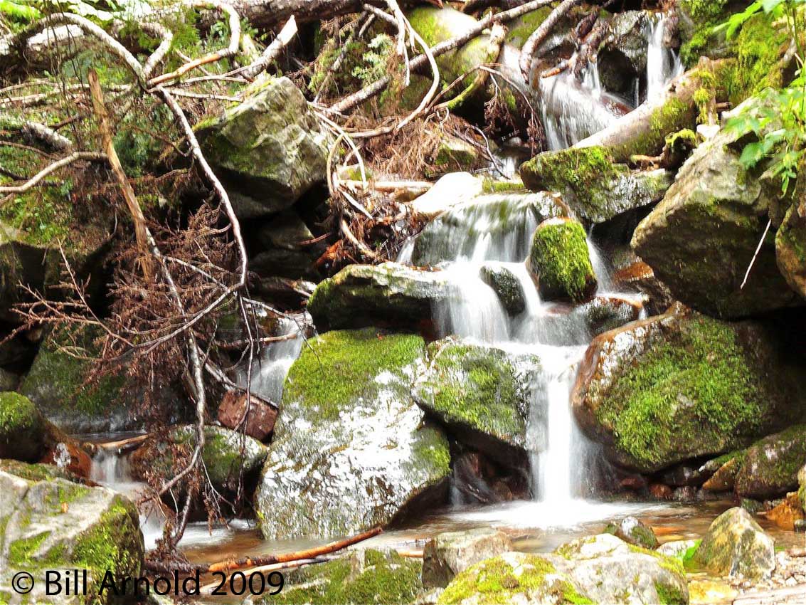
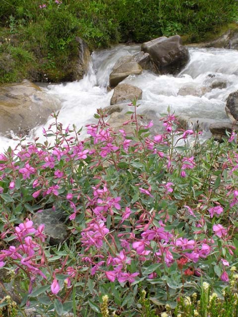
Waterfalls West of McBride
Hellroaring Falls:
This trail is unmarked traveling along the north side of Hellroaring Creek. The trailhead is located about 19km up the Morkill FSR (see Morkill Old-Growth Cedar Trail for directions to the Morkill FSR). Park your vehicle on the right (east) side of the road immediately after crossing the Hellroaring bridge. Follow the Hellroaring upstream into the woods up a steep hill. The trail will level off and you will find yourself in a unique old-growth hemlock forest surrounded by a very thick carpet of moss. In about 5-10 minutes you will reach the Hellroaring Falls located in an impressive canyon. Please do not step off the trail as once stepped on the moss dies. Watch your footing on the rocks at the waterfall.
Morkill Falls:
The most impressive waterfalls of the Robson Valley. Use extreme caution when viewing. Footing at the edge is bad and there is a steep drop into the falls. See Morkill Old-Growth Cedar Trail for directions to the Morkill FSR. Drive about 34km up the Morkill FSR to a small gravel parking area on the right (east) just before crossing another Morkill River bridge. Park here and follow the short, rugged trail to the loud, main falls. Three waterfalls can be viewed from this location. The third
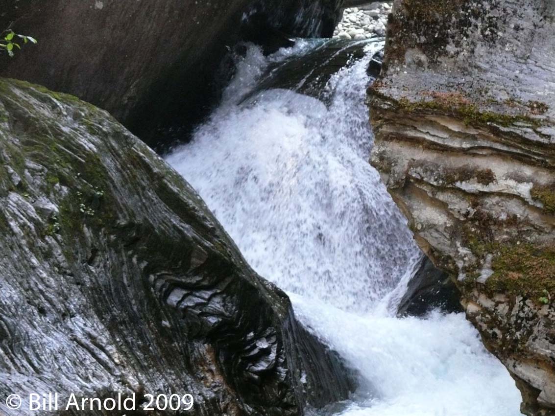
waterfall can be seen through the forest to the left (northeast) of the waterfall directly across the river from this viewpoint. Another waterfall viewpoint is located at the end of a short but rough trail found just across the Morkill bridge.
TreeBeard Falls: Located 94 km west of McBride in the Ancient Forest. (see Ancient Forest for directions)
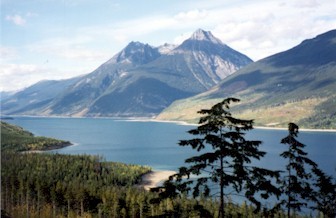
Lakes West of McBride
La Salle Lakes:
The LaSalle Lake Recreation Site, maintained by the McBride Community Forest, is about about 46 km west of McBride on Highway 16. This site has recently been expanded and offers 20 campsites (picnic tables and fire rings), 2 outhouses, bear proof garbage containers, firewood, a small beach area, dock and swimming/diving platform. LaSalle Lake is a non-motorized lake and provides good fishing opportunities as it is stocked with trout. Near the crest of a hill, there is a sign to the left (south side) denoting the La Salle Lake road and recreation site. This is a short gravel road road traveling downhill through remnants of a cedar/hemlock forest ending at one of the La Salle Lakes. A smaller second La Salle Lake is accessed from a gravel parking area on the left (south) side of Highway 16, 2km east of the road to the first lake above. A short hiking trail through old-growth spruce reaches the second La Salle Lake. Watch for birds and amphibians.
Trails East of McBride
Beaver/Holmes River Falls Trail:
Easy/One km. The signed trail, maintained by the McBride Community Forest, is located off Highway 16, about 11 km east of McBride, before the Highway 16 bridge over the Beaver/Holmes River. The trail travels upstream along the north side of the Beaver River. A falls is located within 1 km of the parking area. Watch for Douglas-fir forests, salmon, and black bear.
The Beaver (Holmes) River Recreation Site is located on the east bank of the Beaver River. You can access the site by turning north off Highway 16 and travelling 1 km up the Holmes Forest Service Road.
This recreation site offers 8-10 campsites (picnic tables and fire rings), an outhouse, firewood and garbage pickup during the summer months. During the fall salmon run, visitors can view spawning salmon at a side channel of the Beaver River located at km 5 on the Holmes Forest Service Road.
Caution should always be used when traveling on potentially active logging roads.
Natural Arch Trail:
Difficult/9km. Located about 22km east of McBride on the north side of Highway 16 along Baker Creek. Just after passing a rest area on your right (south) there will be a road leaving Highway 16 to the left (north). The marked trailhead is within 1km up this road on the right (east). This road can be considered a 4-wheel drive road so you may want to park your vehicle and walk to the trailhead. An impressive stone arch can be viewed from the ridge at the top. Watch for grizzly bear, black bear, and mountain goat sign. Many species of birds and bats can also be found.
Dunster Trail:
Difficult/8km. From Highway 16 turn right (south) onto the Dunster access road 29km east of McBride. Follow this road about 4km until it ends at a “T”. Turn left (east) and immediately turn right (south) onto Pepper Pit Road. Follow this road 2km to the gravel pit at the end. The trail starts at the top of the pit and is steep all the way to the alpine. There are good views from the top on clear days of the Raush River watershed (the largest undeveloped, unprotected watershed left in the southern half of BC).
Spittal Creek:
Easy/2km. Located on the north side of Highway 16 about 7km west of the junction of Highways 5 and 16. There is a sign on the highway at the parking area. This is a self-guided interpretive trail and a pleasant walk through an old Douglas-fir forest along the rushing Spittal Creek
.
Tete Jaune Cache/Mcclennan River Spawning Ground Trail:
Easy/3km. About 1km west of the junction of Highways 5 and 16 turn south onto Blackman Road, cross the Fraser bridge, and turn right (west) onto Old Tete Jaune Road at about 3km. Cross the railroad tracks at 2.5km and take the first gravel road on the right (north). This road leads to the spawning ground site. There will be a sign denoting the spawning grounds. Watch for elk, deer, moose, and a large variety of birds.
Lost Lake Trail:
Moderate/6km. From Tete Jaune Cache, at the junction of Highways 5 and 16, go about 2km east on Highway 16 and park at the (second) rest area on the right (south), about 1km east of the weigh scales. Cross the highway at the west end of the rest area and you will find a sign at the trailhead. This trail leads through old Douglas-fir to a small, beautiful lake at 1.5km in a canyon with mountain and cliff viewscapes and two lookouts. Watch for waterfowl, beaver, muskrat, and warblers.
Jackman Flats:
Easy/many kilometers of flat trail. Located about 6km south of the Highway 5 and 16 junctions off of Highway 5. A sign denoting Jackman Flats can be seen on the right (west) side of Highway 5. You can choose from 5 trail loops varying in length from 1-6km or a 2km long interpretive trail from the parking area. Jackman Flats contains a unique assemblage of vegetation in a pine forest growing on sand dunes. Much care and effort went into making this trail system. It is educational and enjoyable. Be extremely careful not to miss or step on the many rare species of plant life. Many birds and mammals will be encountered.
Valemount Salmon Spawning Viewing Area:
Easy/very short walk. Located off Highway 5 in Valemount on Swift Creek. Instead of turning east off of Highway 5 into Valemount centre turn west at the same intersection and then immediately turn right (north). Follow the signs and go 1/4km to the spawning grounds and footbridge at the edge of a paved parking area.
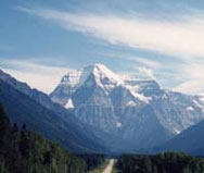
Mount Robson:
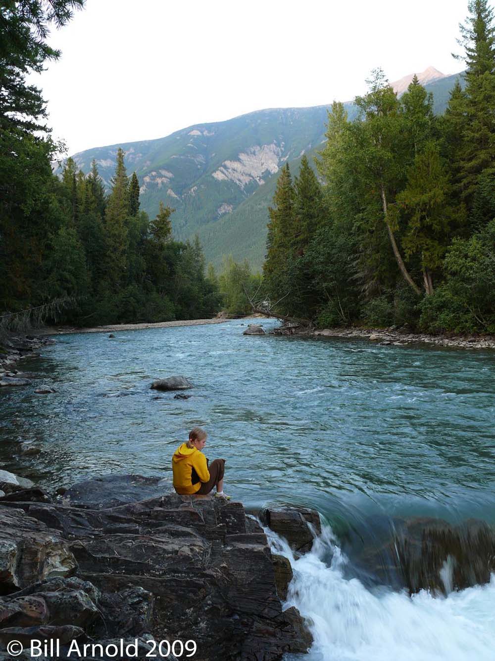
Mount Robson is located 80km east of McBride toward Jasper. The Kinney and Berg Lake trails are beautiful. The Berg Lake Trail toward (Emperor Falls) and beyond is one of the most popular hiking trails in the Rockies. Big trees, waterfalls, canyons, glaciers, and snow-capped mountains are around every turn. The first 6-7km to Kinney Lake can be mountain biked and would be rated as being easy to moderate. The trail gets a bit more difficult as it progresses beyond Kinney Lake. The hike is in the shadow of Mt. Robson, the highest peak in the Canadian Rockies at 3954m. The trail starts off at the parking area 2km behind the visitor center (and cafe) at the top of Mt. Robson pass off the Yellowhead highway. Gas, camping, and a cafe convenience store are located nearby. The trail is well marked and the hike progresses in several stages, appropriate for various abilities. The first stage of the hike takes you on a very wide and well marked trail to Kinney Lake. Big trees, some interpretive signs, and rushing water characterize the first 5km. At Kinney Lake, some 6km into the trail, there is a primitive campground, and a rest area. This is a nice destination for those out for a day hike. Mountain bikers can carry on a little further around the lake until they see a bike lock-up. You must continue on from there by foot, and you’ll see a sign for two options at the metal bike rack. Both reconnect with the main trail at the end of the lake (and a larger bridge). Shortly afterward you’ll face an uphill section, with switchbacks, which flattens out and carries on for a few more kilometers to the Ranger station and Whitehorn Campground — near the suspension bridge. This is a great day one stop. You must reserve your campsite with BC parks. The next stage continues on 1 km beyond the campground and then 4km of daunting steep uphill towards Berg Lake via Emperor Falls. Lots of lookouts. You are in the valley of 1000 Falls. When you reach Berg lake you are treated to views of Mt. Robson and the Emperor Face. You can also watch the Glacier calf into the water. There is primitive camping and a BC Parks hut at Berg Lake. Many smaller day hikes are available from here; to the toe of the Robson Glacier for one. Although some people go to Berg Lake on day one, consider making it a two-day hike (biking to the 7km point helps a bit) and, you’ll want a full day or two at Berg Lake, minimum. Although the trail is easy to follow, this is wilderness, and be prepared for weather changes, bugs, and wildlife (i.e. bears). Bring your first aid gear, sunscreen, good boots, food, and lots of water even if you are not spending the night.
Groeneveld Trail:
Difficult 8.7km to Groeneveld Peak. GPS trailhead: 53 10.9480N 119 54.0337W 306180.4E 5896280.5N 11. Elevation: 2612ft / 796m. Located 23km east of McBride on Hwy 16. Turn left onto a side road 400m past a hwy rest area. Follow the road until you get to the trail sign for the Natural Stone Arch Trail. The trailhead is shared with the Natural Stone Arch Trail for the first 800m. Then you will find a Groeneveld Trail sign which leads to the right. After 70m the trail crosses the creek. The log bridge is washed out. The trail climbs up to a junction that connects with McNaughton Road. The viewpoint is reach at 5840ft where you can see the Stone Arch Ridge to the north. Great views of the Rocky Mountains and Cariboo Mountains.
Lucille Mountain:
Easy 13km GPS lower parking lot: 53 17.1438N 120 11.8649W 686801.5E 5907502.4N 10. Elevation: 2542ft. / 775m. From the McBride Visitor Centre turn east on 1st ave. for 650m and turn right onto Sansom Road. Continue for another 2.2km. and turn left onto Lucille Mountain Forest Rd. Drive 650m to lower parking lot. At the 4.5km junction take the right fork. The trail continues up through subalpine. There is a cabin 2.7km from the peak. Park at meadow with small kiosk.
McBride Peak
This road should not be attempted with motorhomes or trailers. Four-wheel drive vehicles are strongly recommended.
Those equipped with a suitable 4 wheel drive vehicle may want to venture another 15-20 minutes up to the end of Teare Mountain Road. A short trail leads up from the parking area to the old Forestry Lookout Tower and McBride Peak.
Due to the fragile nature of alpine vegetation, hikers are encouraged to stay on the trail. This is a non-motorized area. ATVs are not allowed in this alpine area.
From the top parking lot, it is a fairly easy 2.1km to McBride Peak, and 4.2km to Mount Teare. GPS upper parking lot: 53.20.2319N 120 7.7448W 691147.9E 5913407.9N 10. Elevation: McBride Peak 7446ft/ 2267m, Mount Teare 7120ft / 2168m. Drive 2.4km east of McBride on Hwy 16 and turn left onto Mountainview Rd. Drive 600m and turn right on Rainbow Rd. The first 6km is on a good steep 2wd road but the last 4km to the upper parking lot is much steeper( 4 wheel drive recommended). The trail follows an old ATV trail to an abandoned fire lookout. There is a junction 600m further. Left goes up to McBride Peak, right goes up to Mount Teare. Great views of McBride.
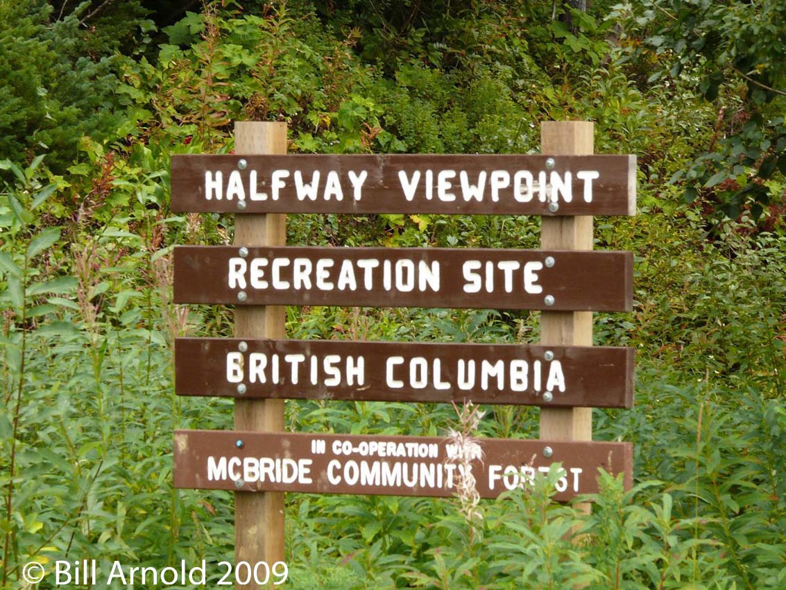
Maintained by the McBride Community Forest, the Half-way Hut Recreation Site is located approximately half-way up the Teare Mountain (McBride Peak) Road. To access this site, head out of McBride East on Highway 16 to Mountainview Road. Turn left onto Mountainview Road and follow along for less than 1 km, then right onto Rainbow Road, which then becomes Teare Mountain Road. Drive up Teare Mountain road for approximately 15 to 20 minutes. Please note that Teare Mountain road is very steep, narrow and windy, with tight switchbacks.
This road should not be attempted with motorhomes or trailers. Four-wheel drive vehicles are strongly recommended.
Those equipped with a suitable 4 wheel drive vehicle may want to venture another 15-20 minutes up to the end of Teare Mountain Road. A short trail leads up from the parking area to the old Forestry Lookout Tower and McBride Peak.
Due to the fragile nature of alpine vegetation, hikers are encouraged to stay on the trail. This is a non-motorized area. ATVs are not allowed in this alpine area.
Mount Terry Fox:
Difficult 10.3km. GPS trailhead: 52 53.8262N 119 18.4321W 344801.0E 5863099.5N 11. Elevation: 3019ft / 920m. From the junction at Tete Jaune Cache, turn south onto Hwy 5 and drive 13km to Stone Road. Turn left. Drive 300m down Stone Rd. and turn left after crossing railroad tracks. There is another fork in the road after 830m, stay left. Leads to the parking lot. Trail leaves to the left of the trail sign. The radio tower is 8.1km from trailhead. The summit is 2.2km further along the ridge to the east
.
Paradise Trail/ Mount Munroe:
Difficult 7.9km to Paradise Ridge 10.2km to Mount Munroe. GPS parking lot: 53 22.8455N 120 15.1178W 682781.4E 5917930.4N 10. Elevation: Paradise Ridge 6733ft / 2050m , Mount Munroe 7590ft / 2311m. Drive 2.4km east of McBride on Hwy 16 and turn left onto Mountainview Rd. Drive 12.6 km. The parking lot is located at a roadside pullout on right side of road. Trail heads east along an old road. There is a junction 800m up. Take left fork. A trail climbs steadily for 7.9km total to Paradise Ridge. The route to Mount Munroe heads east along the ridge.
Spitall Creek Interpretive Trail:
Easy 1.8km. GPS trailhead: 53 0.2649N 119 30.4747W 331719.3E 5875486.5N 11. Elevation: 2688ft / 819m. Drive 56km east of McBride on Hwy 16 and turn left at a large trail sign on edge of hwy. Trail is well travelled and winds through cedar forest which surrounds Spitall Creek.
Waterfalls East of McBride
Beaver Falls:
Travel east from McBride about 11km on Highway 16 until you cross the Beaver (Holmes) River. Turn left (north) onto the Beaver FSR just after crossing the Highway 16 bridge over the Beaver/Holmes River. Drive 1km up this road to see the falls on your left (north). Spawning salmon can be seen jumping the falls during the salmon spawning season from August to October.
Rearguard Falls:
Easy/well used. A very impressive waterfall. Go 4km east on Highway 16 from the junction of Highways 5 and 16. There is a sign on the right (south) side of the highway at the trailhead and parking area. The trail to the waterfall is about a 1km round trip. This is a popular salmon-viewing area since salmon can be seen jumping the waterfall during the salmon spawning season from August to October.
Located 80 km east of McBride on highway 16 in Mount Robson Provincial Park. (see Mount Robson).It is the largest concentration of waterfalls in Canada. Located west of Mount Robson, the valley offers great backpacking country with a few campsites. White Falls, Falls of the Pool, and Emperor Falls are the most exciting of the falls and are all located on the Robson River. Be on the lookout for bears and make sure you store food accordingly. This amazing hiking adventure will start at the Mount Robson Information Centre.
Overlander Falls:
Located 81 km. east of McBride on highway 16, 1.6km past the Mount Robson Visitor Centre. A 500-metre walk from the parking areas provides a view of these scenic waterfalls. An alternative access trail starts at the Robson Meadows Campground and follows the Fraser River to the falls. The Fraser river plunges into a large pool at these falls. The roar of the falls can be heard all along the trail. This is the final stop for those few Chinook salmon that manage to get this far from the ocean.
Lakes East of McBride
Lakes East of McBride
Shere Lake:
A small stocked lake located off the Dunster-Tete Jaune Road. A short trail and wharf provide access to the lake. Suitable for day use only.
Little Lost Lake:
1.5km. GPS trailhead: 52 58.7282N 119 23.8377W 339045.1E 5872384.3N 11. Elevation: 2494ft / 760m. Drive 64km east of McBride on Hwy 16 . Park at the avalanche gates just past the weigh scales. Trail starts on the north side of the hwy where a trail sign marks the start of the trail. The trail leads through old Douglas-fir to a small, beautiful lake in a canyon. There is a small campground with 2 picnic tables. Watch for waterfowl, beaver, muskrat and warblers.
Kinbasket Lake: Located 18 km south of Valemount, at km 22 on the East Canoe Forest Service Road. Fish for kokanee, rainbow trout, Rocky Mountain white fish, burbot and bull trout.
Other Activities
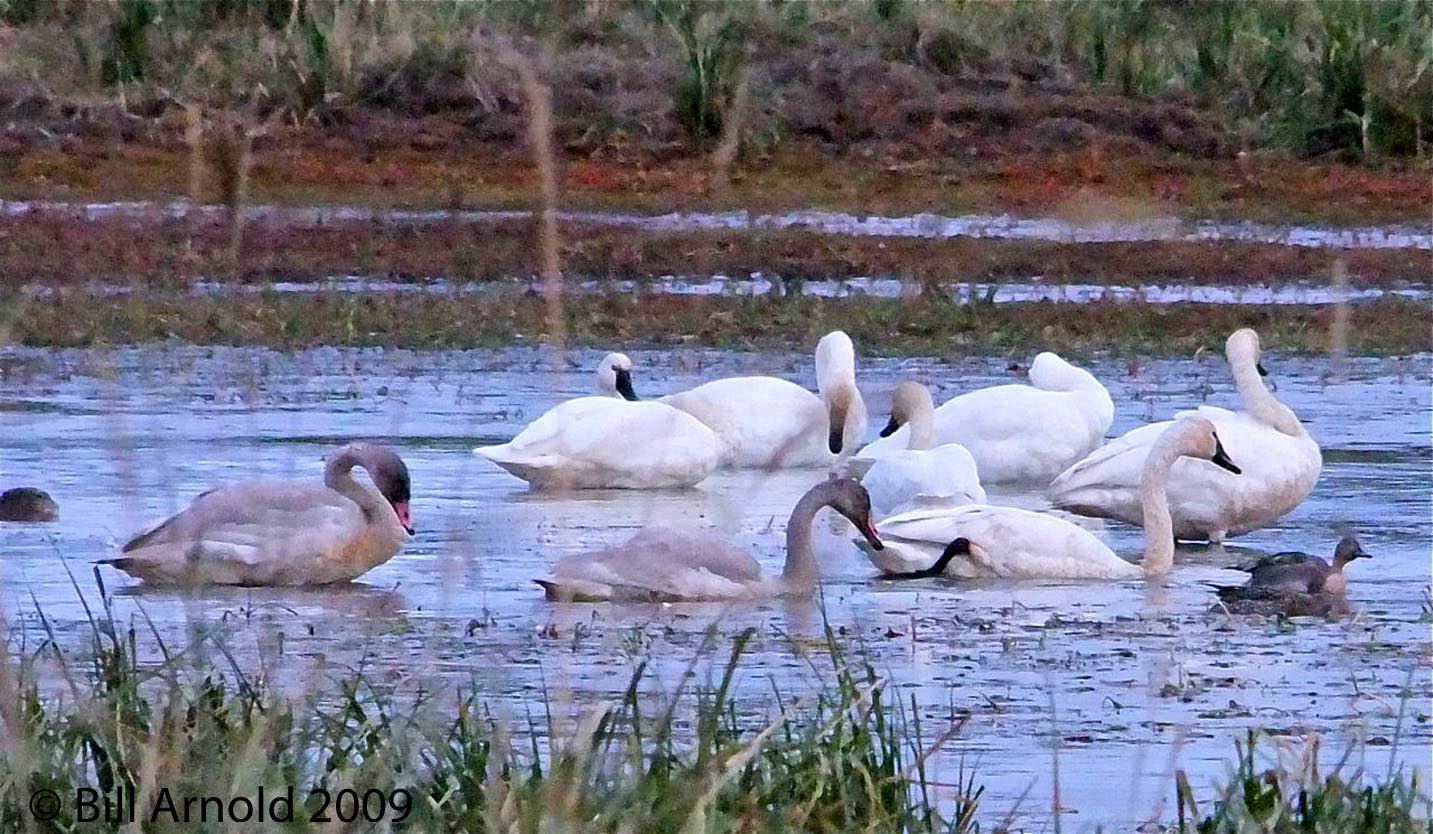
Bird Watching:
McBride is a bird watchers paradise!
There are varied and plentiful opportunities from the valley bottom up to the alpine. More than 170 species have been identified between Mount Robson and Dome Creek. Be sure to visit the McBride Visitor Information Centre for a complete bird list.
Salmon Spawning:
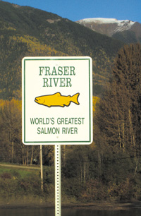
In late August and early September the spawning salmon make their way up the Fraser River through the Robson Valley. Nearing the end of their long journey they are an awesome sight as they prepare to spawn in the numerous tributaries of the Fraser.
White Water Rafting:
Stellar Descents White Water Rafting is located 64 km east of McBride in Tete Jaune just off highway 16.
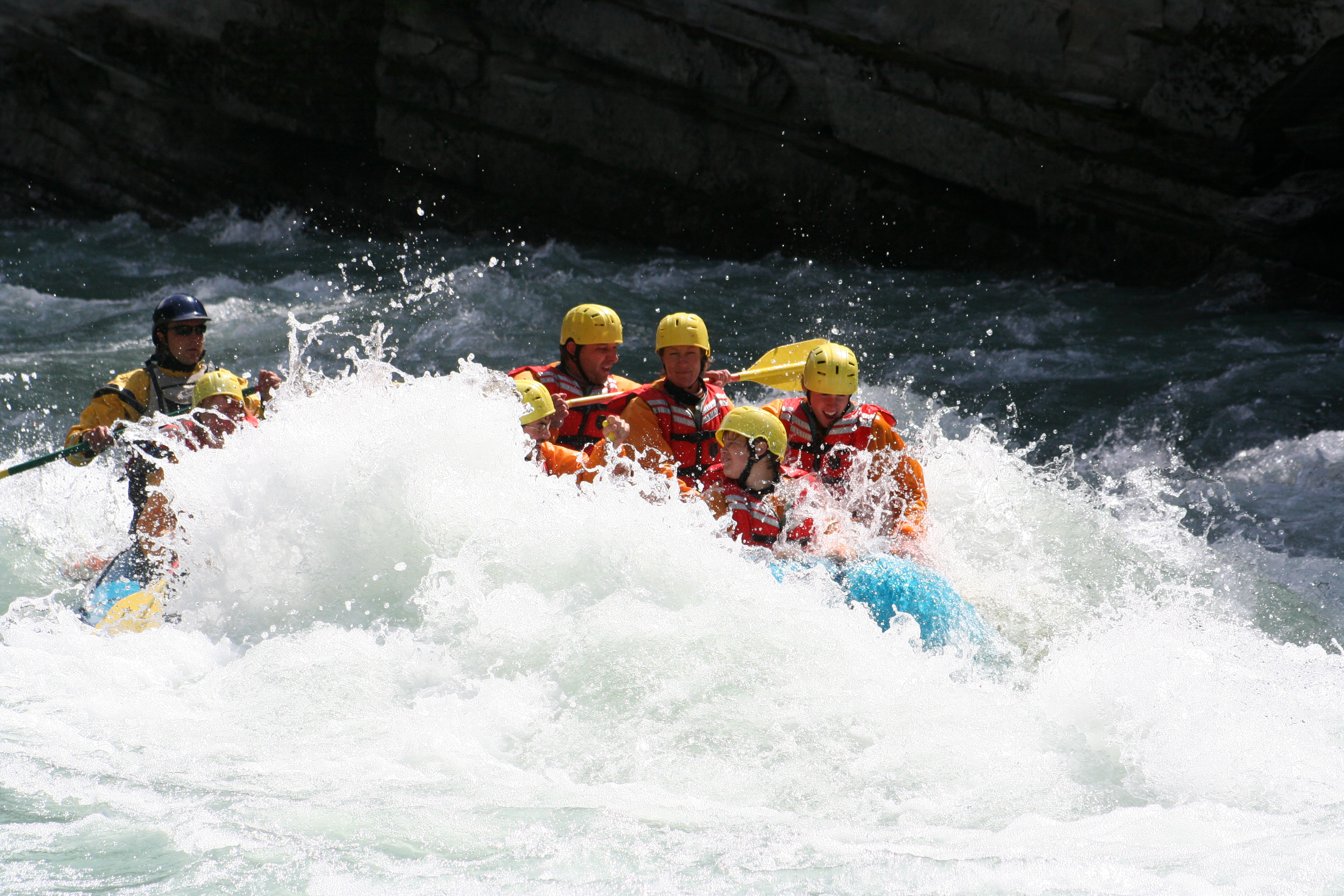
Mount Robson White Water Rafting is located at Mount Robson Lodge 5 km west of Mount Robson Park on Highway 16. There are scenic floats available also.
Mountain Biking:
There is a beautiful network of bike trails branching off of Rainbow Road, which leads to McBride Peak on Teare Mountain. 2.4km east of McBride is Mountain View Rd.
Turn left and continue for another 600m and turn right on Rainbow Rd. The terrain is varied and there is a map of the trail system about 1km up Rainbow Rd. Be cautious of difficult trails as well as a challenging gravel road up to the trails.
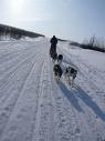
Dogsledding:
Indulge in 1 full hour of mushing on this fast and furious trail. Great for groups or those that are looking for a quick taste of dog sledding. Trip concludes with a hot beverage and homemade treats back at the trailhead, or Travel by dog 2.5 -3 hours through the silent undisturbed beauty of winter and all it has to offer. This is a great hands-on opportunity to venture deep into the heart of the Canadian Rockies. Enjoy the crisp mountain air and the beautiful scenery that surrounds you while you warm up with a hearty trail side lunch, cooked over an open campfire, hot apple cider and homemade treats. During this time you will have the opportunity to learn the history of both the area and the art of dog sledding.
Snowmobiling:
McBride has some of the best alpine powder riding in the country, with an average snowfall in excess of ten feet. Riding elevations vary from 3,500′ timber riding to 9,000′ hill climbing. If you are a beginner, looking for some family fun, an intermediate or experienced rider, we have it all!
Snowshoeing:

Unlimited opportunities for snowshoe enthusiasts, from guide tours to back country adventures. Easy trips to features such as waterfalls, or more ambitious treks to backcountry cabins for an overnight stay are available.
Cross Country Skiing
The Yellowhead Ski Club, in cooperation with the Ministry of Forests, maintains grooms and sets track on 30kms in two trail systems. Both areas offer family oriented terrain with easy access to parking lots, cabins and outdoor toilets.
Dore Valley Trails: These lower elevation trails can be reached from either Dore River Road or Lamming Pit Road at 5km and 7km along Highway 16, west of McBride. A warming hut, toilets and parking area are provided. Approximately 10km of trail are groomed and track set, as snow conditions permit.
Bell Mountain Trails: This trail system is located 9km west of McBride. Access is from km-5 on Bell Mountain Road, with additional parking at km-1 and km-3. The km-5 site also has a cabin and toilets. This area offers 10, 5, 2.5 and 1.2km courses.
Telemark Skiing & Touring
For the more experienced skiers, two backcountry cabins can be found well off the Dore River Forest access roads. One cabin sits at the foot of the Eagle Glacier in the South Dore Valley. The Ozalenka Cabin rests on the alpine in the West Dore Valley.
Come explore your opportunity!
Visit McBride in the beautiful Robson Valley
For more information contact the Visitor Centre in the train station at 1000 1st Avenue
1-866-569-3366
come2mcbride@telus.net